
1972 Map of Sunray
USGS Topo · Published 1974About this map
The town of Sunray stands as a central hub in the Texas Panhandle during the early 1970s, defined by its relationship to energy, agriculture, and transportation. This survey reveals a landscape heavily punctuated by gas and oil wells, while the Chicago Rock Island and Pacific railroad provides the industrial backbone for the region. To the north, the terrain is sharply carved by the meandering path of North Palo Duro Creek, which cuts through the high plains near the Sherman Co Moore Co line. Local aviation history is notable here, with both the Sunray Airport and the Roy Browder Landing Field serving the community's needs. Civic life is anchored by the City Park, the High Sch, and the Lane Memorial Cem, reflecting a period of established growth and regional infrastructure in Moore County.
Find a feature on this map
15 named features on this map. Tap any name to fly to it.
Don’t see what you’re looking for? This feature index may not catch every label — zoom into the map to look around manually.
Map Details
Editions of this 1972 Sunray Map
This is the sole edition of this map. No revisions or reprints were ever made.
Other maps of this area

1954 · Perryton
USGS Topo · 1:250,000

1954 · Amarillo
USGS Topo · 1:250,000

1958 · Perryton
USGS Topo · 1:250,000

1958 · Amarillo
USGS Topo · 1:250,000

1963 · Cactus East
USGS Topo · 1:24,000

1965 · Spurlock Chapel
USGS Topo · 1:24,000
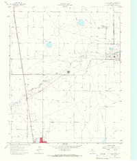
1965 · Dumas North
USGS Topo · 1:24,000

1972 · Dumas NE
USGS Topo · 1:24,000

1972 · Capps Switch
USGS Topo · 1:24,000
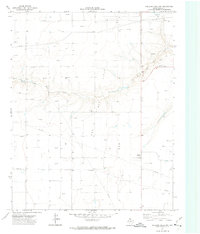
1972 · Pollard Creek NW
USGS Topo · 1:24,000