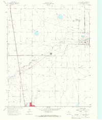
1965 Map of Dumas North
USGS Topo · Published 1966About this map
The Oil and Gas Field of Moore County dominates this 1960s landscape, illustrating the industrial footprint of the Texas Panhandle at mid-century. A network of pipelines and service roads crisscrosses the high plains, connecting extraction sites to significant processing facilities like the Refinery, Smelter, and a Chemical Plant. In the southern portion of the sheet, the northern edge of Dumas shows early suburban expansion, featuring local landmarks such as the Radio Tower (KDDD) and a Drive-in Theater.
Find a feature on this map
21 named features on this map. Tap any name to fly to it.
Don’t see what you’re looking for? This feature index may not catch every label — zoom into the map to look around manually.
Map Details
Editions of this 1965 Dumas North Map
This is the sole edition of this map. No revisions or reprints were ever made.
Other maps of this area

1954 · Tucumcari
USGS Topo · 1:250,000

1954 · Perryton
USGS Topo · 1:250,000

1954 · Amarillo
USGS Topo · 1:250,000

1954 · Dalhart
USGS Topo · 1:250,000

1958 · Perryton
USGS Topo · 1:250,000

1958 · Amarillo
USGS Topo · 1:250,000

1958 · Tucumcari
USGS Topo · 1:250,000

1958 · Dalhart
USGS Topo · 1:250,000

1962 · Dalhart
USGS Topo · 1:250,000

1963 · Cactus East
USGS Topo · 1:24,000