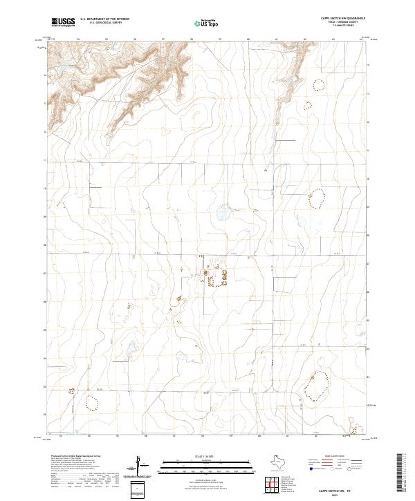
2022 Map of Capps Switch NW
USGS Topo · Published 2022About this map
Coldwater Cr carves a series of winding canyons and bluffs across the northwestern corner of this Sherman County landscape, providing a stark contrast to the high plains surrounding it. This area reflects the modern agricultural grid of the Texas Panhandle, defined by long straight roads such as Co RD U and Co RD W that segment the prairie into vast sections. The transportation network is anchored by state-maintained routes including FM 1573 and FM 1060, which connect the rural homesteads and farm operations to larger regional hubs. The map illustrates the specialized water management of the region, where numerous small, unnamed depressions and ponds dot the terrain, while W Craig Rd provides access to the more topographically varied land near the creek. This survey provides a clear view of the rural infrastructure and natural drainage patterns essential to the Panhandle's ranching and farming economy.
Find a feature on this map
8 named features on this map. Tap any name to fly to it.
Don’t see what you’re looking for? This feature index may not catch every label — zoom into the map to look around manually.
Map Details
Editions of this 2022 Capps Switch NW Map
This is the sole edition of this map. No revisions or reprints were ever made.
Other maps of this area

1954 · Perryton
USGS Topo · 1:250,000

1958 · Perryton
USGS Topo · 1:250,000

1972 · Capps Switch
USGS Topo · 1:24,000

1972 · Sunray
USGS Topo · 1:24,000
1974 · Capps Switch SE
USGS Topo · 1:24,000

1974 · Stevens SE
USGS Topo · 1:24,000

1974 · Sunray 1 SW
USGS Topo · 1:24,000

1974 · Sunray 1 SE
USGS Topo · 1:24,000

1974 · Capps Switch NW
USGS Topo · 1:24,000
1974 · Pleasure Pond
USGS Topo · 1:24,000