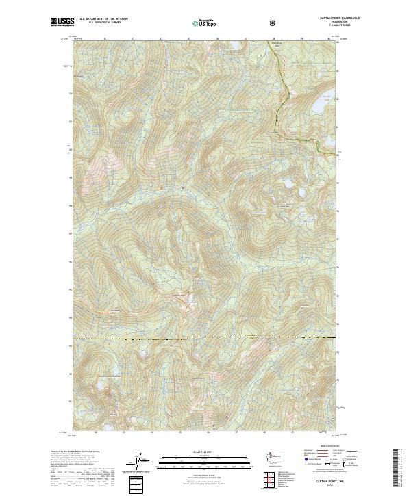
2023 Map of Captain Point
USGS Topo · Published 2023About this map
Captain Point and Scorpion Mtn anchor this high-elevation landscape within the Henry M Jackson Wilderness and Wild Sky Wilderness. The 2023 survey documents a complex system of alpine drainage where the North Fork Rapid River and Rapid River converge, fed by numerous high-altitude basins including those containing Heather Lake, Bertha Lake, and Glasses Lake. Significant transit corridors are marked by the Pacific Crest National Scenic Trl as it traverses the eastern ridgeline near Grizzly Peak and Wenatchee Pass. The map also details the administrative division between the Snoqualmie National Forest and Wenatchee National Forest, reflecting contemporary federal land management in the Cascade Range. Recreational infrastructure is evident through the inclusion of the Johnson Ridge Trl and various Forest Service routes like NFD 6710 RD.
Find a feature on this map
49 named features on this map. Tap any name to fly to it.
Don’t see what you’re looking for? This feature index may not catch every label — zoom into the map to look around manually.
Map Details
Editions of this 2023 Captain Point Map
This is the sole edition of this map. No revisions or reprints were ever made.
Other maps of this area

1902 · Skykomish
USGS Topo · 1:125,000

1905 · Skykomish
USGS Topo · 1:125,000

1957 · Wenatchee
USGS Topo · 1:250,000

1965 · Captain Point
USGS Topo · 1:24,000

1965 · Evergreen Mtn
USGS Topo · 1:24,000

1965 · Stevens Pass
USGS Topo · 1:24,000

1965 · Skykomish
USGS Topo · 1:24,000

1965 · Poe Mountain
USGS Topo · 1:24,000
1965 · Bench Mark Mtn
USGS Topo · 1:24,000
1965 · Scenic
USGS Topo · 1:24,000