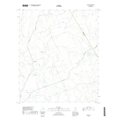
2019 Map of Caradan
USGS Topo · Published 2019About this map
Caradan sits as the central settlement in this portion of the Texas Hill Country, where the landscape is defined by the headwaters and tributaries of the Lampasas River. The topography is marked by significant elevations like Huckabee Hill and Lookout Mtn, while the drainage system of Mustang Creek and North Bennett Creek carves through the limestone terrain. This area reflects a long-standing ranching tradition, evidenced by the extensive network of ranch-to-market roads such as Ranch Rd 575 and Ranch Rd 2005. Small-scale water management is visible through numerous named catchments, including Stillwell Lake, Parker Lake, and the series of McCasland Lakes along the eastern border. Near the Hamilton and Mills County line, the Pecan Wells Cem serves as a significant genealogical landmark for families of this rural community.
Find a feature on this map
46 named features on this map. Tap any name to fly to it.
Don’t see what you’re looking for? This feature index may not catch every label — zoom into the map to look around manually.
Map Details
Editions of this 2019 Caradan Map
This is the sole edition of this map. No revisions or reprints were ever made.
Other maps of this area

1885 · San Saba
USGS Topo · 1:125,000

1887 · Lampasas
USGS Topo · 1:125,000

1888 · Hamilton
USGS Topo · 1:125,000

1889 · Brownwood
USGS Topo · 1:125,000

1894 · Hamilton
USGS Topo · 1:125,000

1894 · Lampasas
USGS Topo · 1:125,000

1894 · Brownwood
USGS Topo · 1:125,000

1894 · San Saba
USGS Topo · 1:125,000

1928 · Goldthwaite
USGS Topo · 1:62,500

1931 · Mullin
USGS Topo · 1:62,500