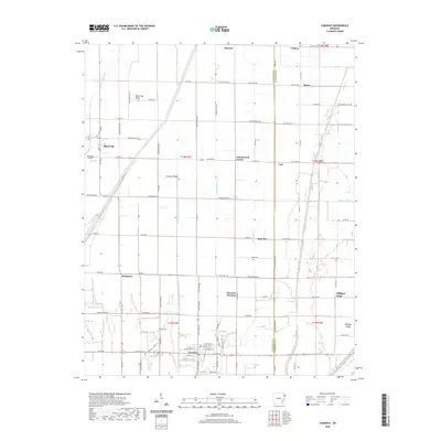
2020 Map of Caraway
USGS Topo · Published 2020About this map
The town of Caraway and its surrounding agricultural plains are defined by an extensive network of drainage infrastructure, reflecting a landscape engineered for cultivation. This 2020 survey illustrates how Honey Cypress Ditch Number 4 and Buffalo Creek Ditch manage the hydrology of the Mississippi Alluvial Plain. The map shows the transition from Craighead to Mississippi County, with settlements like Black Oak and Monette connected by a grid of rural roads such as Ar 148 HWY. Family and local history is anchored at the Caraway Cem and near the Caraway Schools Ln. Minor rises in elevation like Black Oak Ridge and Coopers Ridge offer subtle relief in an otherwise low-lying region. Smaller named locales, including Cottonwood Corner, Hancock, and Hancock Junction, mark the intersections of rural life and commerce across the delta.
Find a feature on this map
69 named features on this map. Tap any name to fly to it.
Don’t see what you’re looking for? This feature index may not catch every label — zoom into the map to look around manually.
Map Details
Editions of this 2020 Caraway Map
This is the sole edition of this map. No revisions or reprints were ever made.
Other maps of this area

1939 · Evadale
USGS Topo · 1:62,500

1941 · Leachville
USGS Topo · 1:62,500

1941 · Manila
USGS Topo · 1:62,500

1941 · Marked Tree
USGS Topo · 1:62,500

1953 · Memphis
USGS Topo · 1:250,000

1956 · Leachville
USGS Topo · 1:62,500

1956 · Manila
USGS Topo · 1:62,500

1956 · Evadale
USGS Topo · 1:62,500

1956 · Marked Tree
USGS Topo · 1:62,500

1956 · Memphis
USGS Topo · 1:250,000