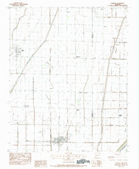
1983 Map of Caraway
USGS Topo · Published 1984About this map
The low-lying alluvial plains of Craighead County define this 1983 survey, where an extensive drainage network transformed the Eastern Arkansas landscape into productive farmland. Settlements like Caraway and Black Oak serve as focal points in a region dominated by precisely engineered waterways, including Honey Cypress Ditch and Buffalo Creek Ditch. These man-made channels were essential for managing the water table across the flats surrounding Coopers Ridge and Milligan Ridge. Local landmarks such as Mt Pleasant Ch and Rowes Chapel anchor the rural community, while the Caraway Cem provides a point of interest for genealogists tracking family ties in the area. In the southeast corner, the natural course of the Right Hand Chute of Little River contrasts with the straight lines of the surrounding irrigation and drainage systems.
Find a feature on this map
27 named features on this map. Tap any name to fly to it.
Don’t see what you’re looking for? This feature index may not catch every label — zoom into the map to look around manually.
Map Details
Editions of this 1983 Caraway Map
This is the sole edition of this map. No revisions or reprints were ever made.
Other maps of this area

1939 · Evadale
USGS Topo · 1:62,500

1941 · Leachville
USGS Topo · 1:62,500

1941 · Manila
USGS Topo · 1:62,500

1941 · Marked Tree
USGS Topo · 1:62,500

1953 · Memphis
USGS Topo · 1:250,000

1956 · Leachville
USGS Topo · 1:62,500

1956 · Manila
USGS Topo · 1:62,500

1956 · Evadale
USGS Topo · 1:62,500

1956 · Marked Tree
USGS Topo · 1:62,500

1956 · Memphis
USGS Topo · 1:250,000