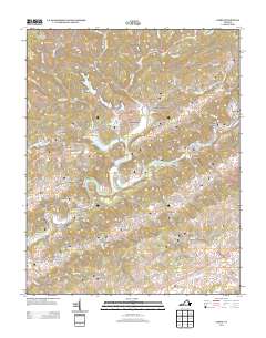
2013 Map of Carbo
USGS Topo · Published 2013About this map
The Clinch River carves a winding path through this corner of Russell County, defining the location of historic settlements like Cleveland and Carterton. The landscape is characterized by its significant karst topography, notably the Back Valley Sinkhole Valley and the rugged ridges of Brushy Ridge and Sandy Ridge. Small communities and family-named locales are dispersed throughout the hollows, including Counts, Candler, and Dickenson Corner.
Find a feature on this map
105 named features on this map. Tap any name to fly to it.
Don’t see what you’re looking for? This feature index may not catch every label — zoom into the map to look around manually.
Map Details
Editions of this 2013 Carbo Map
This is the sole edition of this map. No revisions or reprints were ever made.
Other maps of this area

1886 · Grundy
USGS Topo · 1:125,000

1890 · Grundy
USGS Topo · 1:125,000

1892 · Grundy
USGS Topo · 1:125,000

1897 · Bristol
USGS Topo · 1:125,000

1902 · Bristol
USGS Topo · 1:125,000

1913 · Clintwood
USGS Topo · 1:62,500

1914 · Bucu
USGS Topo · 1:48,000

1915 · Clintwood
USGS Topo · 1:62,500

1916 · Bucu
USGS Topo · 1:62,500

1918 · Carterton
USGS Topo · 1:62,500