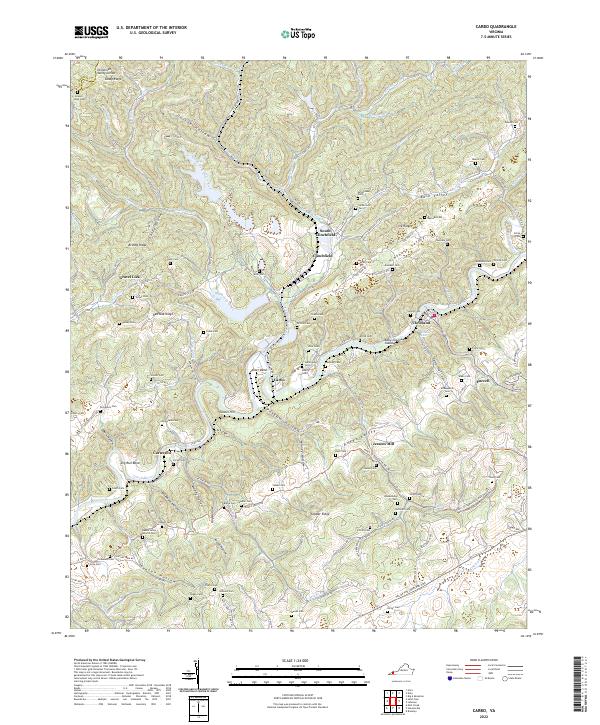
2022 Map of Carbo
USGS Topo · Published 2022About this map
Clinch River meanders through the heart of this Russell County landscape, defining the development of settlements like Cleveland and Carbo. The terrain is characterized by a dense network of hollows and ridges, including Copper Ridge and Red Oak Ridge, which separate the river valley from smaller communities such as Gravel Lick and South Clinchfield. The map reveals a deeply rooted rural society, evidenced by the high density of family-named burial grounds like Rasnake Cem, McReynolds Cem, and Musick Cem that dot the hillsides.
Find a feature on this map
126 named features on this map. Tap any name to fly to it.
Don’t see what you’re looking for? This feature index may not catch every label — zoom into the map to look around manually.
Map Details
Editions of this 2022 Carbo Map
This is the sole edition of this map. No revisions or reprints were ever made.
Other maps of this area

1886 · Grundy
USGS Topo · 1:125,000

1890 · Grundy
USGS Topo · 1:125,000

1892 · Grundy
USGS Topo · 1:125,000

1897 · Bristol
USGS Topo · 1:125,000

1902 · Bristol
USGS Topo · 1:125,000

1913 · Clintwood
USGS Topo · 1:62,500

1914 · Bucu
USGS Topo · 1:48,000

1915 · Clintwood
USGS Topo · 1:62,500

1916 · Bucu
USGS Topo · 1:62,500

1918 · Carterton
USGS Topo · 1:62,500