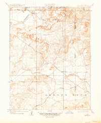
1909 Map of Carbondale
USGS Topo · Published 1947About this map
The Cosumnes River corridor in 1907 serves as a focal point for settlement and early infrastructure along the Sacramento and Amador county line. Small rural hubs like Michigan Bar and Bridge House are centered around river crossings and proximity to water, while the Southern Pacific railroad defines the southern landscape near the community of Carbondale. The map illustrates a developed network of rural education, identifying four distinct schoolhouses including Stone House School and Michigan Bar School.
Find a feature on this map
19 named features on this map. Tap any name to fly to it.
Don’t see what you’re looking for? This feature index may not catch every label — zoom into the map to look around manually.
Map Details
Editions of this 1909 Carbondale Map
2 editions found

Other maps of this area

1889 · Jackson
USGS Topo · 1:125,000

1891 · Sacramento
USGS Topo · 1:125,000

1891 · Placerville
USGS Topo · 1:125,000

1892 · Jackson
USGS Topo · 1:125,000

1892 · Sacramento
USGS Topo · 1:125,000

1892 · Placerville
USGS Topo · 1:125,000

1893 · Placerville
USGS Topo · 1:125,000

1893 · Sacramento
USGS Topo · 1:125,000

1894 · Lodi
USGS Topo · 1:125,000

1897 · Jackson
USGS Topo · 1:125,000