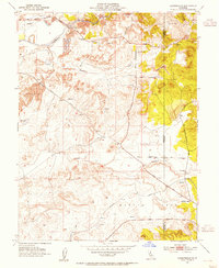
1953 Map of Carbondale
USGS Topo · Published 1954About this map
The Cosumnes River corridor near the boundary of Sacramento and Amador County reveals a landscape heavily altered by industrial activity in the mid-20th century. Vast fields of Dredge Tailings flank the riverbanks, particularly around the site of Michigan Bar, where the legacy of large-scale mining operations is etched into the topography. To the south, the Southern Pacific railroad line cuts across the terrain, serving the small community of Carbondale, while local history is preserved at the Michigan Bar Cemetery and Live Oak Cemetery. The map documents a rural economy transitioning between its gold-rush roots and mid-century utility, evidenced by the network of local thoroughfares like Jackson Road and Ione Road that connect isolated landmarks such as the Alabama House and Bridge House. Seasonal drainages like Arroyo Seco and Laguna Creek snake through the hills, providing the only natural contrast to the geometric patterns of dredge refuse.
Find a feature on this map
23 named features on this map. Tap any name to fly to it.
Don’t see what you’re looking for? This feature index may not catch every label — zoom into the map to look around manually.
Map Details
Editions of this 1953 Carbondale Map
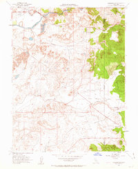
2 editions found
Other maps of this area

1889 · Jackson
USGS Topo · 1:125,000

1891 · Sacramento
USGS Topo · 1:125,000

1891 · Placerville
USGS Topo · 1:125,000

1892 · Jackson
USGS Topo · 1:125,000

1892 · Sacramento
USGS Topo · 1:125,000

1892 · Placerville
USGS Topo · 1:125,000

1893 · Placerville
USGS Topo · 1:125,000

1893 · Sacramento
USGS Topo · 1:125,000

1894 · Lodi
USGS Topo · 1:125,000

1897 · Jackson
USGS Topo · 1:125,000