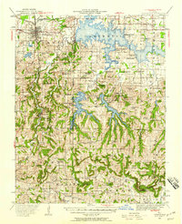
1941 Map of Carbondale
USGS Topo · Published 1958About this map
Carbondale serves as the focal point of this 1941 revision, situated where the Illinois Central railroad intersects with Illinois 13. The landscape is defined by a massive expansion of managed waterways and protected lands, most notably the sprawling Crab Orchard Lake and the adjacent National Wildlife Refuge. To the south, the terrain becomes more complex near Giant City State Park, a region marked by the newer reservoirs of Little Grassy Lake and Devils Kitchen Lake.
Find a feature on this map
87 named features on this map. Tap any name to fly to it.
Don’t see what you’re looking for? This feature index may not catch every label — zoom into the map to look around manually.
Map Details
Editions of this 1941 Carbondale Map
2 editions found

Other maps of this area

1909 · West Frankfort
USGS Topo · 1:62,500

1910 · Herrin
USGS Topo · 1:62,500

1910 · Murphysboro
USGS Topo · 1:62,500

1918 · Vienna
USGS Topo · 1:62,500

1919 · Vienna
USGS Topo · 1:62,500

1920 · Jonesboro
USGS Topo · 1:62,500

1920 · Dongola
USGS Topo · 1:62,500

1922 · Carbondale
USGS Topo · 1:62,500

1923 · Dongola
USGS Topo · 1:62,500

1923 · Jonesboro
USGS Topo · 1:62,500