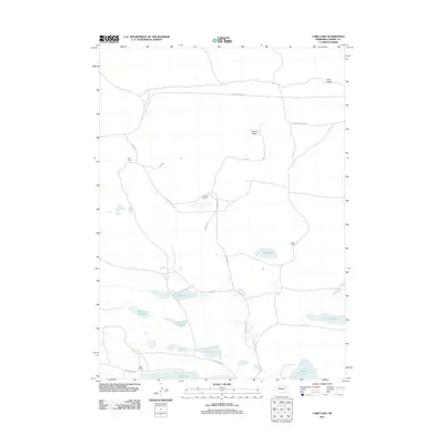
2011 Map of Card Lake
USGS Topo · Published 2011About this map
Ideal Valley and Survey Valley define the northern terrain of this section of Cherry County, Nebraska, where a network of unpaved roads and trails connects isolated homesteads and ranching outposts. This 2011 survey illustrates a landscape of intermittent water and sandhill topography, characterized by a series of shallow basins including Card Lake, Bos Lake, and Indian Lake. The human footprint is sparse, centered on established operations like Frye Ranch, Jamison Ranch, and Lowe Ranch, which are linked by corridors such as Ashby Rd and Survey Valley Rd. In the south, larger bodies of water like Alkali Lake and Downing Lake sit near the boundary of the quadrangle, serving as focal points in an otherwise open ranching country. The presence of features like Red Mill Lake and Tony Lake suggests the vital role of these depressions in the local hydrology and grazing economy.
Find a feature on this map
20 named features on this map. Tap any name to fly to it.
Don’t see what you’re looking for? This feature index may not catch every label — zoom into the map to look around manually.
Map Details
Editions of this 2011 Card Lake Map
This is the sole edition of this map. No revisions or reprints were ever made.
Other maps of this area

1948 · Ashby
USGS Topo · 1:62,500

1948 · Bingham
USGS Topo · 1:62,500

1948 · Spade Ranch
USGS Topo · 1:62,500

1949 · Ashby
USGS Topo · 1:62,500

1949 · Turpin Lake
USGS Topo · 1:62,500

1950 · Spade Ranch
USGS Topo · 1:62,500

1950 · Bingham
USGS Topo · 1:62,500

1951 · Turpin Lake
USGS Topo · 1:62,500

1955 · Alliance
USGS Topo · 1:250,000

1957 · Alliance
USGS Topo · 1:250,000