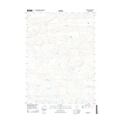
2014 Map of Card Lake
USGS Topo · Published 2014About this map
Survey Valley and Ideal Valley define the undulating topography of this portion of Cherry County, where the landscape is punctuated by numerous isolated basins. A chain of water bodies, including Card Lake, Bos Lake, and the larger Little Dad Lake, indicates the complex hydrology of the Nebraska Sandhills. Local transportation is facilitated by named routes such as Survey Valley Rd and Ashby Rd, which wind through the terrain to connect these remote ranching areas. The presence of Red Mill Lake and Alkali Lake further highlights the diversity of the local wetlands, providing a detailed record of the region's surface water features as they appeared in 2014.
Find a feature on this map
17 named features on this map. Tap any name to fly to it.
Don’t see what you’re looking for? This feature index may not catch every label — zoom into the map to look around manually.
Map Details
Editions of this 2014 Card Lake Map
This is the sole edition of this map. No revisions or reprints were ever made.
Other maps of this area

1948 · Ashby
USGS Topo · 1:62,500

1948 · Bingham
USGS Topo · 1:62,500

1948 · Spade Ranch
USGS Topo · 1:62,500

1949 · Ashby
USGS Topo · 1:62,500

1949 · Turpin Lake
USGS Topo · 1:62,500

1950 · Spade Ranch
USGS Topo · 1:62,500

1950 · Bingham
USGS Topo · 1:62,500

1951 · Turpin Lake
USGS Topo · 1:62,500

1955 · Alliance
USGS Topo · 1:250,000

1957 · Alliance
USGS Topo · 1:250,000