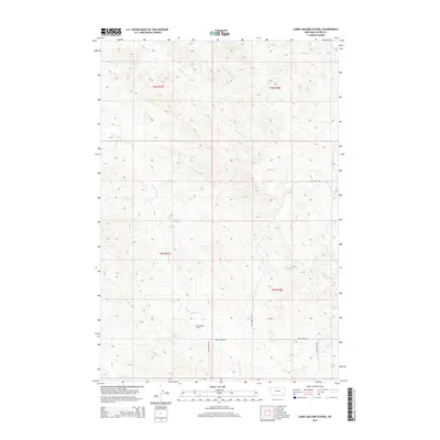
2014 Map of Carey-Malone School
USGS Topo · Published 2014About this map
Carey-Malone School sits centrally in this corner of Custer County, serving as a primary landmark in a landscape defined by an extensive network of ephemeral and perennial watercourses. The drainage patterns of the N Fork Foster Cr and Haddow Cr systems create a complex topography of ridges and draws. These natural features dictated the early transportation routes, such as Foster Creek Rd and Basin Creek Rd, which trace the low-lying valleys between elevations.
Find a feature on this map
19 named features on this map. Tap any name to fly to it.
Don’t see what you’re looking for? This feature index may not catch every label — zoom into the map to look around manually.
Map Details
Editions of this 2014 Carey-Malone School Map
This is the sole edition of this map. No revisions or reprints were ever made.
Other maps of this area

1953 · Miles City
USGS Topo · 1:250,000

1954 · Ekalaka
USGS Topo · 1:250,000

1956 · Ekalaka
USGS Topo · 1:250,000

1957 · Miles City
USGS Topo · 1:250,000

1958 · Miles City
USGS Topo · 1:250,000

1958 · Ekalaka
USGS Topo · 1:250,000

1965 · Ekalaka
USGS Topo · 1:250,000

1969 · Beebe SW
USGS Topo · 1:24,000
1969 · Garland School
USGS Topo · 1:24,000
1969 · Jack Creek
USGS Topo · 1:24,000