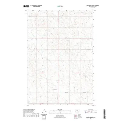
2020 Map of Carey-Malone School
USGS Topo · Published 2020About this map
Carey-Malone School stands as a focal point in this section of Custer County, situated near the headwaters of the N Fork Foster Cr. The landscape is defined by an intricate drainage system including Haddow Cr, Coalbank Cr, and Cottonwood Cr, which carve through the terrain and dictate the local road network. Transport in this rural area follows these natural contours, with routes like Ash Creek Rd and Basin Creek Rd providing essential links between remote holdings. The mapping of these drainages, such as McFee Cr and Butte Cr in the northern townships, illustrates the geographic challenges of the Montana ranching country. This survey by the U.S. Geological Survey and other agencies captures the enduring spatial relationship between isolated public institutions and the watercourses that shaped the county's early development.
Find a feature on this map
22 named features on this map. Tap any name to fly to it.
Don’t see what you’re looking for? This feature index may not catch every label — zoom into the map to look around manually.
Map Details
Editions of this 2020 Carey-Malone School Map
This is the sole edition of this map. No revisions or reprints were ever made.
Other maps of this area

1953 · Miles City
USGS Topo · 1:250,000

1954 · Ekalaka
USGS Topo · 1:250,000

1956 · Ekalaka
USGS Topo · 1:250,000

1957 · Miles City
USGS Topo · 1:250,000

1958 · Miles City
USGS Topo · 1:250,000

1958 · Ekalaka
USGS Topo · 1:250,000

1965 · Ekalaka
USGS Topo · 1:250,000

1969 · Beebe SW
USGS Topo · 1:24,000
1969 · Garland School
USGS Topo · 1:24,000
1969 · Jack Creek
USGS Topo · 1:24,000