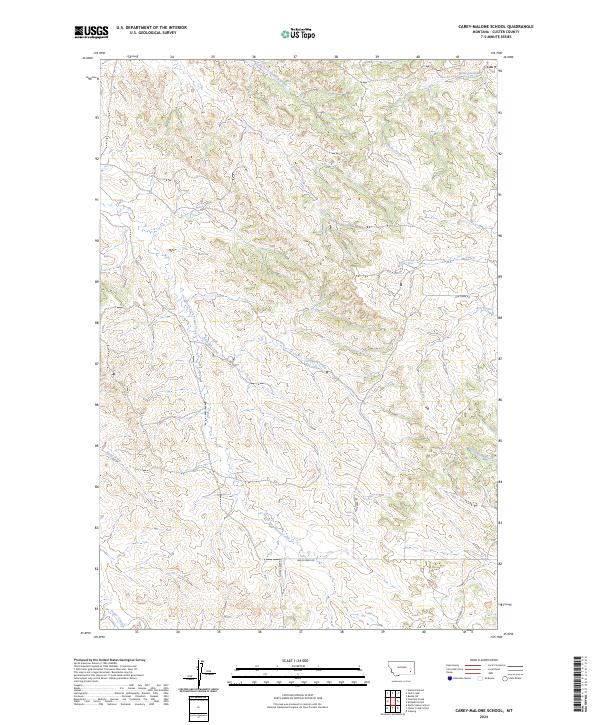
2024 Map of Carey-Malone School
USGS Topo · Published 2024About this map
Foster Creek and its many tributaries define this section of the Montana rangeland, where the drainage network creates a complex system of ridges and coulees. The landscape is marked by the seasonal flow of North Fork Haddow Creek in the north and the winding path of Cottonwood Creek to the east. Human activity is largely confined to a sparse network of unpaved tracks, including Foster Creek Rd and Basin Creek Rd, which follow the natural contours of the valley floors. These corridors provide the primary access through the townships of t2n r47e and t2n r48e, highlighting a traditional Western ranching infrastructure where water sources and low-lying creek beds dictate the placement of local thoroughfares such as Ranch Creek Rd and Ash Creek Rd.
Find a feature on this map
20 named features on this map. Tap any name to fly to it.
Don’t see what you’re looking for? This feature index may not catch every label — zoom into the map to look around manually.
Map Details
Editions of this 2024 Carey-Malone School Map
This is the sole edition of this map. No revisions or reprints were ever made.
Other maps of this area

1953 · Miles City
USGS Topo · 1:250,000

1954 · Ekalaka
USGS Topo · 1:250,000

1956 · Ekalaka
USGS Topo · 1:250,000

1957 · Miles City
USGS Topo · 1:250,000

1958 · Miles City
USGS Topo · 1:250,000

1958 · Ekalaka
USGS Topo · 1:250,000

1965 · Ekalaka
USGS Topo · 1:250,000

1969 · Beebe SW
USGS Topo · 1:24,000
1969 · Garland School
USGS Topo · 1:24,000
1969 · Jack Creek
USGS Topo · 1:24,000