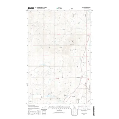
2013 Map of Careywood
USGS Topo · Published 2013About this map
Careywood and the surrounding mountain drainages of Bonner County are documented in this 2013 survey. The landscape is defined by a series of glacial lakes, including Kelso Lake, Round Lake, and Granite Lake, which sit at the base of Long Mtn and Huckleberry Mtn. Local infrastructure supports both recreation and residential life, with dedicated points such as the Kelso Lake Access and Granite Lake Access.
Find a feature on this map
58 named features on this map. Tap any name to fly to it.
Don’t see what you’re looking for? This feature index may not catch every label — zoom into the map to look around manually.
Map Details
Editions of this 2013 Careywood Map
This is the sole edition of this map. No revisions or reprints were ever made.
Other maps of this area

1901 · Sandpoint
USGS Topo · 1:125,000

1903 · Rathdrum
USGS Topo · 1:125,000

1911 · Priest Lake
USGS Topo · 1:250,000

1911 · Sandpoint
USGS Topo · 1:125,000

1913 · Priest Lake
USGS Topo · 1:250,000

1955 · Spokane
USGS Topo · 1:250,000

1958 · Spokane
USGS Topo · 1:250,000

1958 · Sandpoint
USGS Topo · 1:250,000

1961 · Bayview
USGS Topo · 1:24,000

1961 · Spirit Lake East
USGS Topo · 1:24,000