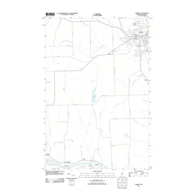
2011 Map of Caribou
USGS Topo · Published 2011About this map
The Aroostook River flows along the southern edge of this landscape, supporting the settlement of Crouseville and the nearby Crouseville Cemetery. To the northeast, the city of Caribou serves as the primary hub, where the Caribou Mill Pond Dam and Caribou Dam manage the waters of Caribou Stream. This 2011 survey documents a mix of municipal infrastructure and rural agricultural roads, including the Caribou Municipal Airport and the Caribou Post Office. The terrain is defined by a network of drainage brooks, such as Mile Brook and Prestile Brook, which weave through the timberlands and fields toward local water bodies like Caribou Lake. Genealogists may find interest in the documented locations of Holy Rosary Cemetery and Evergreen Cemetery, while landmarks like Prestile Hill and Churchill Island provide clear geographical markers in this northern Maine territory.
Find a feature on this map
60 named features on this map. Tap any name to fly to it.
Don’t see what you’re looking for? This feature index may not catch every label — zoom into the map to look around manually.
Map Details
Editions of this 2011 Caribou Map
This is the sole edition of this map. No revisions or reprints were ever made.
Other maps of this area

1929 · Caribou
USGS Topo · 1:48,000

1930 · Fort Fairfield
USGS Topo · 1:48,000

1932 · Caribou
USGS Topo · 1:62,500

1933 · Fort Fairfield
USGS Topo · 1:62,500

1935 · Presque Isle
USGS Topo · 1:62,500

1936 · Mars Hill
USGS Topo · 1:48,000

1940 · Mars Hill
USGS Topo · 1:62,500

1951 · Mars Hill
USGS Topo · 1:62,500

1951 · Fort Fairfield
USGS Topo · 1:62,500

1953 · Fort Fairfield NW
USGS Topo · 1:24,000