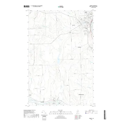
2018 Map of Caribou
USGS Topo · Published 2018About this map
The Aroostook River winds through the southern landscape of this Aroostook County survey, anchoring the settlement of Crouseville where the Hillside Grove Cem, Crouseville Cem, and Munson Christy Cem are clustered along the riverbanks. To the north, the terrain transitions into the developed outskirts of Caribou, a hub defined by the Caribou Municipal Airport and a network of neighborhood streets such as Paris Snow Dr and Laurette St. This modern mapping shows the area's mix of municipal infrastructure and rural tradition, with the Caribou Mill Pond and Caribou Stream providing a hydrological link to the town's industrial roots. The map also documents specific local institutions, such as Pierre's School of Cosmetology and the Northern Maine Veterans Cem, reflecting the social fabric of the community at this recent date.
Find a feature on this map
82 named features on this map. Tap any name to fly to it.
Don’t see what you’re looking for? This feature index may not catch every label — zoom into the map to look around manually.
Map Details
Editions of this 2018 Caribou Map
This is the sole edition of this map. No revisions or reprints were ever made.
Other maps of this area

1929 · Caribou
USGS Topo · 1:48,000

1930 · Fort Fairfield
USGS Topo · 1:48,000

1932 · Caribou
USGS Topo · 1:62,500

1933 · Fort Fairfield
USGS Topo · 1:62,500

1935 · Presque Isle
USGS Topo · 1:62,500

1936 · Mars Hill
USGS Topo · 1:48,000

1940 · Mars Hill
USGS Topo · 1:62,500

1951 · Mars Hill
USGS Topo · 1:62,500

1951 · Fort Fairfield
USGS Topo · 1:62,500

1953 · Fort Fairfield NW
USGS Topo · 1:24,000