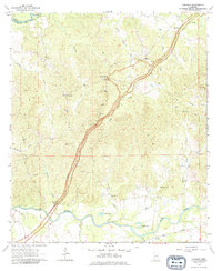
1963 Map of Carlisle
USGS Topo · Published 1979About this map
The Natchez Trace Parkway bisects this landscape of southwestern Mississippi, following the high ground between numerous creek drainages. The settlement of Rocky Springs sits at the northern end of this corridor, while the Illinois Central railroad defines the southern border near Carlisle. The terrain is characterized by a complex network of watercourses, including Little Sand Creek and Clarks Creek, which flow toward the Big Black River or Bayou Pierre.
Find a feature on this map
32 named features on this map. Tap any name to fly to it.
Don’t see what you’re looking for? This feature index may not catch every label — zoom into the map to look around manually.
Map Details
Editions of this 1963 Carlisle Map
2 editions found
Other maps of this area

1939 · Yokena
USGS Topo · 1:62,500

1953 · Natchez
USGS Topo · 1:250,000

1955 · Jackson
USGS Topo · 1:250,000

1956 · Natchez
USGS Topo · 1:250,000

1959 · Natchez
USGS Topo · 1:250,000

1961 · Jackson
USGS Topo · 1:250,000

1962 · Jackson
USGS Topo · 1:250,000

1962 · Utica West
USGS Topo · 1:24,000

1963 · Carlisle
USGS Topo · 1:24,000

1963 · Port Gibson
USGS Topo · 1:24,000