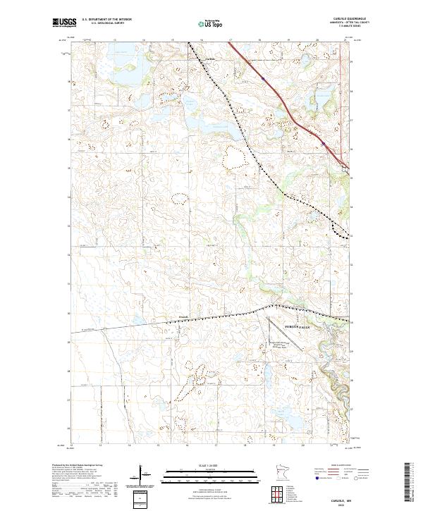
2022 Map of Carlisle
USGS Topo · Published 2022About this map
Carlisle and the nearby settlement of French anchor this corner of Otter Tail County, where a complex network of glacial lakes and prairie waterways dominates the landscape. The Pelican River meanders south through the center of the sheet, eventually meeting the Otter Tail River as it passes through the northwestern edge of Fergus Falls. This confluence has historically shaped the region's transport and agriculture, evidenced here by the dense grid of county highways and local roads such as Old Hwy 52 and Co Hwy 11.
Find a feature on this map
40 named features on this map. Tap any name to fly to it.
Don’t see what you’re looking for? This feature index may not catch every label — zoom into the map to look around manually.
Map Details
Editions of this 2022 Carlisle Map
This is the sole edition of this map. No revisions or reprints were ever made.
Other maps of this area

1910 · Wendell
USGS Topo · 1:62,500

1913 · Fergus Falls
USGS Topo · 1:62,500

1913 · Wendell
USGS Topo · 1:62,500

1919 · Rothsay
USGS Topo · 1:62,500

1951 · Rothsay
USGS Topo · 1:62,500

1951 · Campbell
USGS Topo · 1:62,500

1953 · Fargo
USGS Topo · 1:250,000

1956 · Fargo
USGS Topo · 1:250,000

1966 · Carlisle
USGS Topo · 1:24,000
1973 · Dayton Hollow Dam
USGS Topo · 1:24,000