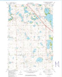
1973 Map of Dayton Hollow Dam
USGS Topo · Published 1975About this map
Otter Tail River and the Mustinka River converge in this Minnesota landscape, where water management and conservation define the rural character. The presence of the Dayton Hollow Reservoir and Orwell Lake highlights the infrastructure of the mid-1970s, as the land was increasingly designated for wildlife protection across the Aastad State Wildlife Management Area and various National Waterfowl Production Areas. Small-scale settlements like Parkdale and Ness appear alongside the Burlington Northern railroad corridor, which skirts the eastern edge of Chautauqua Lake. This area preserves several localized historical markers, including the Aastad Ch Cem and Knollwood Cem, providing concrete points of interest for genealogists tracing family ties to these prairie townships.
Find a feature on this map
29 named features on this map. Tap any name to fly to it.
Don’t see what you’re looking for? This feature index may not catch every label — zoom into the map to look around manually.
Map Details
Editions of this 1973 Dayton Hollow Dam Map
This is the sole edition of this map. No revisions or reprints were ever made.
Other maps of this area

1910 · Wendell
USGS Topo · 1:62,500

1913 · Ashby
USGS Topo · 1:62,500

1913 · Fergus Falls
USGS Topo · 1:62,500

1913 · Wendell
USGS Topo · 1:62,500

1915 · Underwood
USGS Topo · 1:62,500

1953 · Fargo
USGS Topo · 1:250,000

1953 · Brainerd
USGS Topo · 1:250,000

1956 · Fargo
USGS Topo · 1:250,000

1957 · Brainerd
USGS Topo · 1:250,000

1958 · Brainerd
USGS Topo · 1:250,000