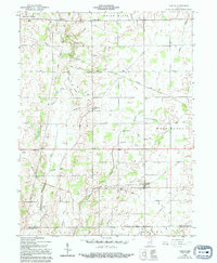
1960 Map of Carlos
USGS Topo · Published 1994About this map
White River and Sugar Creek drain the landscape of southern Randolph County, where 19th-century land boundaries like the Treaty Line and Indian Boundary intersect. These historical lines once separated organized settlements from tribal territories, and their diagonal orientation still dictates modern property divisions and road paths. The map centers on the small agricultural village of Huntsville, with its namesake Huntsville Cem and Huntsville Drain, alongside other rural communities such as Unionport, Buena Vista, and Carlos. Local genealogy is well-documented through the numerous country houses of worship including Martindale Ch and Salem Ch, each with adjacent burial grounds like Salem Cem. A heavy infrastructure presence is noted by a prominent Pipeline and modern utilities like the TV Tower near the Washington Township border.
Find a feature on this map
45 named features on this map. Tap any name to fly to it.
Don’t see what you’re looking for? This feature index may not catch every label — zoom into the map to look around manually.
Map Details
Editions of this 1960 Carlos Map
3 editions found

Other maps of this area

1915 · New Paris
USGS Topo · 1:48,000

1916 · Winchester
USGS Topo · 1:48,000

1918 · Winchester
USGS Topo · 1:62,500

1918 · New Paris
USGS Topo · 1:62,500

1943 · Winchester
USGS Topo · 1:62,500

1952 · Maxville
USGS Topo · 1:24,000

1952 · Farmland
USGS Topo · 1:24,000

1953 · Cincinnati
USGS Topo · 1:250,000

1953 · Muncie
USGS Topo · 1:250,000

1956 · Muncie
USGS Topo · 1:250,000