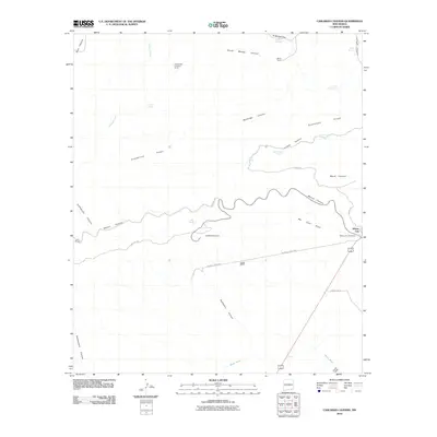
2010 Map of Carlsbad Caverns
USGS Topo · Published 2010About this map
Carlsbad Caverns anchors this 2010 topographic record, highlighting the gateway to the cavern system through the winding Walnut Canyon. The landscape is defined by the sharp relief of Guadalupe Ridge and a network of deep drainage basins including Lechuguilla Canyon and Bat Cave Draw. Human settlement is centered on the cluster at Whites City, where the Whites City Post Office sits at the junction of the National Parks Hwy and County Rd 724. Outside the township, the land is marked by isolated pastoral holdings such as the W W Smith and Sons Ranch, White Ranch, and Lowe Ranch. Water sources are critical landmarks in this arid terrain, with Mosley Springs, Stetson Seep, and Cottonwood Spring providing vital points of reference along the canyon floors. The Black River flows through the southern portion of the sheet near Chosa Draw, marking the edge of the plateau's rugged breaks.
Find a feature on this map
33 named features on this map. Tap any name to fly to it.
Don’t see what you’re looking for? This feature index may not catch every label — zoom into the map to look around manually.
Map Details
Editions of this 2010 Carlsbad Caverns Map
This is the sole edition of this map. No revisions or reprints were ever made.
Other maps of this area

1940 · Bandanna Point
USGS Topo · 1:62,500

1940 · Carlsbad Caverns West
USGS Topo · 1:62,500

1943 · Carlsbad Caverns West
USGS Topo · 1:62,500

1943 · Bandanna Point
USGS Topo · 1:62,500

1943 · West Carlsbad
USGS Topo · 1:62,500

1945 · West Carlsbad
USGS Topo · 1:62,500

1945 · Carlsbad Caverns East
USGS Topo · 1:62,500

1947 · Carlsbad Caverns East
USGS Topo · 1:62,500

1954 · Carlsbad
USGS Topo · 1:250,000

1958 · Carlsbad
USGS Topo · 1:250,000