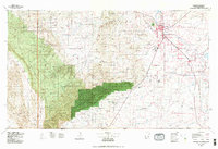
1979 Map of Carlsbad
USGS Topo · Published 1979About this map
Carlsbad Caverns National Park dominates the southern reaches of this landscape, where the subterranean wonders of the Guadalupe Mountains meet the high desert floor. The map illustrates a transitional geography between the dramatic Cueva Escarpment and the agricultural river valleys to the east. The Pecos River serves as the primary lifeblood for the region, supporting settlements such as Carlsbad, Loving, and Malaga through a network of canals and reservoirs like Avalon Lake.
Find a feature on this map
52 named features on this map. Tap any name to fly to it.
Don’t see what you’re looking for? This feature index may not catch every label — zoom into the map to look around manually.
Map Details
Editions of this 1979 Carlsbad Map
2 editions found
Other maps of this area

1925 · Orla 2-b
USGS Topo · 1:48,000

1931 · Orla
USGS Topo · 1:62,500

1933 · Guadalupe Peak
USGS Topo · 1:48,000

1935 · El Paso Gap
USGS Topo · 1:62,500

1936 · El Paso Gap
USGS Topo · 1:48,000

1939 · Carlsbad
USGS Topo · 1:62,500

1939 · Nash Draw
USGS Topo · 1:62,500

1940 · El Paso Gap
USGS Topo · 1:62,500

1940 · Guadalupe Peak
USGS Topo · 1:62,500

1940 · Bandanna Point
USGS Topo · 1:62,500