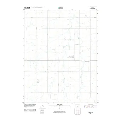
2009 Map of Carlton
USGS Topo · Published 2009About this map
The settlement of Carlton serves as the central hub of this Dickinson County landscape, organized by a precise grid of agricultural avenues and local roads. The town's small footprint is defined by Main Ave, 1st St, and N 7th St, reflecting the characteristic rural planning of the Kansas plains. Beyond the town limits, the terrain is drained by the winding courses of West Holland Creek and East Holland Creek, which cut through the sectional survey lines and influence the placement of regional thoroughfares like Eden Rd and Deer Rd.
Find a feature on this map
25 named features on this map. Tap any name to fly to it.
Don’t see what you’re looking for? This feature index may not catch every label — zoom into the map to look around manually.
Map Details
Editions of this 2009 Carlton Map
This is the sole edition of this map. No revisions or reprints were ever made.
Other maps of this area

1889 · Abilene
USGS Topo · 1:125,000

1894 · Abilene
USGS Topo · 1:125,000

1955 · Kipp
USGS Topo · 1:24,000

1955 · Gypsum
USGS Topo · 1:24,000

1955 · Hutchinson
USGS Topo · 1:250,000

1959 · Hutchinson
USGS Topo · 1:250,000

1963 · Abilene SW
USGS Topo · 1:24,000
1963 · Holland
USGS Topo · 1:24,000

1964 · Elmo
USGS Topo · 1:24,000

1964 · Carlton
USGS Topo · 1:24,000