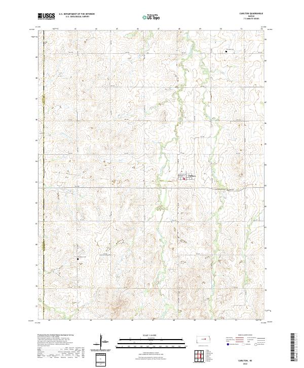
2022 Map of Carlton
USGS Topo · Published 2022About this map
Carlton serves as the central hub for this agrarian landscape in eastern Kansas, positioned where the tributaries of the Holland Creek system begin to carve the prairie. The map details a strictly organized grid of rural roads, including Solomon Rd marking the boundary between Saline and Dickinson Counties. This transition from the flat uplands to the drainage of W Holland Cr and E Holland Cr creates a localized relief that has historically influenced the placement of farmsteads and infrastructure. Local genealogy is well-supported by the inclusion of Fairview Cem to the northeast and Woodlawn Cem to the southwest, providing specific reference points for researchers tracing families in this section of the Smoky Hills region. The network of section-line roads like Barn Rd and Camp Rd underscores the enduring legacy of the Public Land Survey System in defining the Kansas countryside.
Find a feature on this map
32 named features on this map. Tap any name to fly to it.
Don’t see what you’re looking for? This feature index may not catch every label — zoom into the map to look around manually.
Map Details
Editions of this 2022 Carlton Map
This is the sole edition of this map. No revisions or reprints were ever made.
Other maps of this area

1889 · Abilene
USGS Topo · 1:125,000

1894 · Abilene
USGS Topo · 1:125,000

1955 · Kipp
USGS Topo · 1:24,000

1955 · Gypsum
USGS Topo · 1:24,000

1955 · Hutchinson
USGS Topo · 1:250,000

1959 · Hutchinson
USGS Topo · 1:250,000

1963 · Abilene SW
USGS Topo · 1:24,000
1963 · Holland
USGS Topo · 1:24,000

1964 · Elmo
USGS Topo · 1:24,000

1964 · Carlton
USGS Topo · 1:24,000