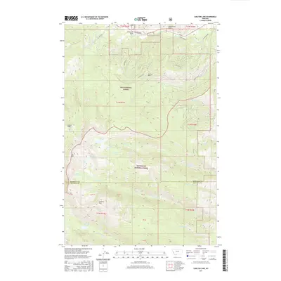
2017 Map of Carlton Lake
USGS Topo · Published 2017About this map
Lolo National Forest and Bitterroot National Forest meet in this mountainous region where the Missoula and Ravalli county lines converge. The landscape is defined by its high-altitude water bodies, including Carlton Lake, Reed Lake, and the distinctive S One Horse and N One Horse Lakes. These alpine basins are tucked beneath prominent summits such as Lolo Peak and Sweeney Peak, which provide the headwaters for numerous drainages like One Horse and Carlton Creeks.
Find a feature on this map
38 named features on this map. Tap any name to fly to it.
Don’t see what you’re looking for? This feature index may not catch every label — zoom into the map to look around manually.
Map Details
Editions of this 2017 Carlton Lake Map
This is the sole edition of this map. No revisions or reprints were ever made.
Other maps of this area

1912 · Missoula
USGS Topo · 1:125,000

1956 · Hamilton
USGS Topo · 1:250,000

1959 · Hamilton
USGS Topo · 1:250,000

1960 · Hamilton
USGS Topo · 1:250,000

1964 · Hamilton
USGS Topo · 1:250,000

1964 · Dick Creek
USGS Topo · 1:24,000
1964 · Blue Mountain
USGS Topo · 1:24,000
1964 · Camp Creek
USGS Topo · 1:24,000
1964 · Southwest Missoula
USGS Topo · 1:24,000

1964 · St. Joseph Peak
USGS Topo · 1:24,000