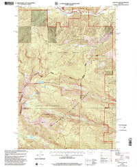
1998 Map of Carlton Lake
USGS Topo · Published 2002About this map
Lolo National Forest and the Bitterroot National Forest converge in this high-altitude terrain along the Missoula and Ravalli County line. The landscape is defined by the sharp transition from the Lolo Creek drainage in the north to the glacial cirques and high peaks of the Selway-Bitterroot Wilderness in the south. High summits including Mormon Peak and Sweeney Peak overlook a series of alpine water bodies, such as Carlton Lake, Little Carlton Lake, and McClain Lake. In the lower elevations near the northern boundary, the Fort Fizzle Picnic Area marks a point of historical interest along the creek. Traces of human activity are largely confined to the network of drainage systems like Mormon Creek and McClain Creek, alongside a few established trails that navigate the ridges and gulches, including Lantern Ridge and Sweeney Ridge.
Find a feature on this map
33 named features on this map. Tap any name to fly to it.
Don’t see what you’re looking for? This feature index may not catch every label — zoom into the map to look around manually.
Map Details
Editions of this 1998 Carlton Lake Map
This is the sole edition of this map. No revisions or reprints were ever made.
Other maps of this area

1912 · Missoula
USGS Topo · 1:125,000

1956 · Hamilton
USGS Topo · 1:250,000

1959 · Hamilton
USGS Topo · 1:250,000

1960 · Hamilton
USGS Topo · 1:250,000

1964 · Hamilton
USGS Topo · 1:250,000

1964 · Dick Creek
USGS Topo · 1:24,000
1964 · Blue Mountain
USGS Topo · 1:24,000
1964 · Camp Creek
USGS Topo · 1:24,000
1964 · Southwest Missoula
USGS Topo · 1:24,000

1964 · St. Joseph Peak
USGS Topo · 1:24,000