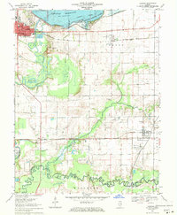
1969 Map of Carlyle
USGS Topo · Published 1971About this map
Carlyle Reservoir dominates the northern reaches of this landscape, its controlled waters meeting the South Shore State Park and reshaping the topography of the Kaskaskia River valley. The map documents a mid-century period of intense energy extraction, evidenced by widespread petroleum operations including the Huey South Oil Field, Hoffman Oil Field, and the expansive Lake Posey East Oil Field.
Find a feature on this map
42 named features on this map. Tap any name to fly to it.
Don’t see what you’re looking for? This feature index may not catch every label — zoom into the map to look around manually.
Map Details
Editions of this 1969 Carlyle Map
This is the sole edition of this map. No revisions or reprints were ever made.
Other maps of this area

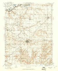
1910 · Carlyle
USGS Topo · 1:62,500

1914 · Centralia
USGS Topo · 1:62,500

1931 · Hoyleton
USGS Topo · 1:48,000
1932 · Nashville
USGS Topo · 1:62,500

1935 · Centralia
USGS Topo · 1:62,500
1936 · Nashville
USGS Topo · 1:62,500

1943 · Ashley
USGS Topo · 1:62,500

1946 · Ashley
USGS Topo · 1:62,500

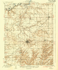
1948 · Carlyle
USGS Topo · 1:62,500

1958 · Belleville
USGS Topo · 1:250,000