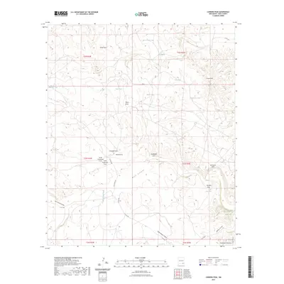
2023 Map of Carnero Peak
USGS Topo · Published 2023About this map
Carnero Peak rises as a prominent landmark in this desert landscape of southern New Mexico, where the terrain is defined by a dense network of drainages and seasonal water catchments. The area is marked by numerous draws and canyons, including the significant Dark Canyon and the winding Last Chance Canyon to the west. Evidence of ranching infrastructure and water management is visible through scattered man-made tanks like McIver North Tank and CCC Tank. The land features a complex system of named arroyos such as Kirkendell Draw and Robinia Draw, which provide essential drainage for the high elevations of Azotea Mesa. Towards the southeast, the terrain begins to transition into the northern reaches of the Guadalupe Mountains, characterized by more dramatic relief at Juniper Canyon and the notable Horseshoe Bend formation. This 2023 survey illustrates the continued reliance on unpaved routes like Red Juniper Rd to navigate this arid environment.
Find a feature on this map
35 named features on this map. Tap any name to fly to it.
Don’t see what you’re looking for? This feature index may not catch every label — zoom into the map to look around manually.
Map Details
Editions of this 2023 Carnero Peak Map
This is the sole edition of this map. No revisions or reprints were ever made.
Other maps of this area

1940 · Bandanna Point
USGS Topo · 1:62,500

1940 · Carlsbad Caverns West
USGS Topo · 1:62,500

1943 · Carlsbad Caverns West
USGS Topo · 1:62,500

1943 · Bandanna Point
USGS Topo · 1:62,500

1943 · West Carlsbad
USGS Topo · 1:62,500

1945 · West Carlsbad
USGS Topo · 1:62,500

1945 · Carlsbad Caverns East
USGS Topo · 1:62,500

1947 · Carlsbad Caverns East
USGS Topo · 1:62,500

1954 · Carlsbad
USGS Topo · 1:250,000

1958 · Carlsbad
USGS Topo · 1:250,000