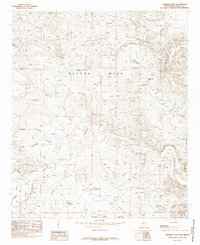
1985 Map of Carnero Peak
USGS Topo · Published 1985About this map
Azotea Mesa dominates this 1985 landscape in Eddy County, defined by a complex network of dry draws and steep relief. The high ground of Carnero Peak and Mc Kittrick Hill stands above a topography carved by drainage systems like Kuykendall Draw and Robina Draw. To the east, the terrain drops sharply at the Ceja Escarpment, while Dark Canyon and Last Chance Canyon cut deep paths through the southern portion of the quadrangle. The map captures an arid environment where water management is critical, evidenced by numerous livestock watering points such as Wild Cow Tank, Hackberry Tank, and Flat Tank. This survey reflects the region's ranching character, focusing on terrain and water access in the rugged hills west of the Pecos River valley.
Find a feature on this map
27 named features on this map. Tap any name to fly to it.
Don’t see what you’re looking for? This feature index may not catch every label — zoom into the map to look around manually.
Map Details
Editions of this 1985 Carnero Peak Map
This is the sole edition of this map. No revisions or reprints were ever made.
Other maps of this area

1940 · Bandanna Point
USGS Topo · 1:62,500

1940 · Carlsbad Caverns West
USGS Topo · 1:62,500

1943 · Carlsbad Caverns West
USGS Topo · 1:62,500

1943 · Bandanna Point
USGS Topo · 1:62,500

1943 · West Carlsbad
USGS Topo · 1:62,500

1945 · West Carlsbad
USGS Topo · 1:62,500

1945 · Carlsbad Caverns East
USGS Topo · 1:62,500

1947 · Carlsbad Caverns East
USGS Topo · 1:62,500

1954 · Carlsbad
USGS Topo · 1:250,000

1958 · Carlsbad
USGS Topo · 1:250,000