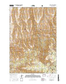
2017 Map of Carney Butte
USGS Topo · Published 2017About this map
Carney Butte and Battle Mountain Summit define the high terrain of this Umatilla County landscape, which sits within the Umatilla National Forest. The geography is characterized by a dense network of drainages and named canyons, such as Schoolhouse Canyon and Tinroof Canyon, which carve through the plateau. Water sources are critical landmarks in this environment, including Willow Spring and Yellow Jacket Spring.
Find a feature on this map
38 named features on this map. Tap any name to fly to it.
Don’t see what you’re looking for? This feature index may not catch every label — zoom into the map to look around manually.
Map Details
Editions of this 2017 Carney Butte Map
This is the sole edition of this map. No revisions or reprints were ever made.
Other maps of this area

1953 · Pendleton
USGS Topo · 1:250,000

1956 · Pendleton
USGS Topo · 1:250,000

1967 · Nye
USGS Topo · 1:24,000

1967 · Granite Meadows
USGS Topo · 1:24,000

1967 · Carney Butte
USGS Topo · 1:24,000

1967 · Pilot Rock
USGS Topo · 1:24,000

1967 · Ukiah
USGS Topo · 1:24,000

1967 · Owens Butte
USGS Topo · 1:24,000

1968 · Gurdane
USGS Topo · 1:24,000
1968 · Vinson
USGS Topo · 1:24,000