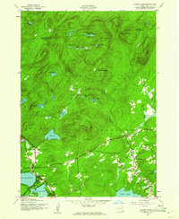
1945 Map of Caroga Lake
USGS Topo · Published 1961About this map
Adirondack State Park encompasses the majority of this mid-century landscape, defined by a dense network of glacial lakes and mountainous terrain. The southern portion of the map shows a concentrated area of human activity and settlement, with the community of Caroga Lake situated between West Caroga Lake and East Caroga Lake. This area was an established destination for seasonal recreation and local industry, connected by roads that wind through the valleys of the Hogback and past Irving Pond.
Find a feature on this map
42 named features on this map. Tap any name to fly to it.
Don’t see what you’re looking for? This feature index may not catch every label — zoom into the map to look around manually.
Map Details
Editions of this 1945 Caroga Lake Map
2 editions found
Other maps of this area

1901 · Lassellsville
USGS Topo · 1:62,500

1903 · Gloversville
USGS Topo · 1:62,500

1903 · Lassellsville
USGS Topo · 1:62,500

1904 · Piseco Lake
USGS Topo · 1:62,500

1906 · Piseco Lake
USGS Topo · 1:62,500

1907 · Lake Pleasant
USGS Topo · 1:62,500

1908 · Piseco Lake
USGS Topo · 1:62,500

1943 · Gloversville
USGS Topo · 1:62,500

1945 · Caroga Lake
USGS Topo · 1:24,000
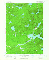
1945 · Canada Lake
USGS Topo · 1:24,000