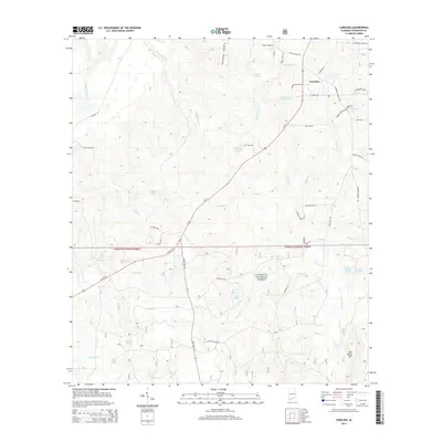
2014 Map of Carolina
USGS Topo · Published 2014About this map
The Carolina community serves as the primary settlement on this sheet, situated north of the expansive Conecuh National Forest. The landscape is defined by a dense network of minor waterways and named water bodies, including Shady Bend Cr and Hog Foot Cr, which drain toward the Conecuh River in the northwest. Local family history is rooted in the landmarks and agricultural tracts named for residents, such as the Carolina Cem and Brantwood Pond.
Find a feature on this map
54 named features on this map. Tap any name to fly to it.
Don’t see what you’re looking for? This feature index may not catch every label — zoom into the map to look around manually.
Map Details
Editions of this 2014 Carolina Map
This is the sole edition of this map. No revisions or reprints were ever made.
Other maps of this area

1953 · Andalusia
USGS Topo · 1:250,000

1957 · Andalusia
USGS Topo · 1:250,000

1971 · Dixie
USGS Topo · 1:24,000

1971 · Bradley
USGS Topo · 1:24,000

1971 · Carolina
USGS Topo · 1:24,000

1971 · Libertyville
USGS Topo · 1:24,000

1971 · Wing
USGS Topo · 1:24,000

1971 · River Falls
USGS Topo · 1:24,000

1971 · Andalusia
USGS Topo · 1:24,000
1971 · Watkins Bridge
USGS Topo · 1:24,000