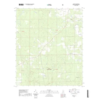
2021 Map of Carolina
USGS Topo · Published 2021About this map
The settlement of Carolina sits at a junction of rural roads in Covington County, surrounded by a complex network of small water bodies and drainage basins. This landscape is defined by its many named ponds and lakes, including Brantwood Pond, Dogwood Lake, and the numerous depressions of Mossy Ponds and Indigo Ponds. To the south, the terrain becomes more protected as it enters the Conecuh National Forest, where the topography rises toward Red Wash Hill and the banks of the Conecuh River.
Find a feature on this map
54 named features on this map. Tap any name to fly to it.
Don’t see what you’re looking for? This feature index may not catch every label — zoom into the map to look around manually.
Map Details
Editions of this 2021 Carolina Map
This is the sole edition of this map. No revisions or reprints were ever made.
Other maps of this area

1953 · Andalusia
USGS Topo · 1:250,000

1957 · Andalusia
USGS Topo · 1:250,000

1971 · Dixie
USGS Topo · 1:24,000

1971 · Bradley
USGS Topo · 1:24,000

1971 · Carolina
USGS Topo · 1:24,000

1971 · Libertyville
USGS Topo · 1:24,000

1971 · Wing
USGS Topo · 1:24,000

1971 · River Falls
USGS Topo · 1:24,000

1971 · Andalusia
USGS Topo · 1:24,000
1971 · Watkins Bridge
USGS Topo · 1:24,000