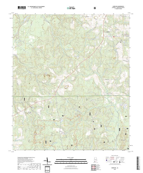
2024 Map of Carolina
USGS Topo · Published 2024About this map
Carolina serves as a central hub in this Southern Alabama landscape, where the agricultural outskirts of Covington County meet the protected lands of the Conecuh National Forest. The geography is defined by a dense network of water bodies, from the prominent Conecuh River winding through the western edge to smaller family-named landmarks like Kelley Pond and Harrelson Pond. These water sources, including the cluster at Mossy Ponds and Nellie Ponds, likely influenced the historical settlement patterns and land use in this timber-rich region.
Find a feature on this map
69 named features on this map. Tap any name to fly to it.
Don’t see what you’re looking for? This feature index may not catch every label — zoom into the map to look around manually.
Map Details
Editions of this 2024 Carolina Map
This is the sole edition of this map. No revisions or reprints were ever made.
Other maps of this area

1953 · Andalusia
USGS Topo · 1:250,000

1957 · Andalusia
USGS Topo · 1:250,000

1971 · Dixie
USGS Topo · 1:24,000

1971 · Bradley
USGS Topo · 1:24,000

1971 · Carolina
USGS Topo · 1:24,000

1971 · Libertyville
USGS Topo · 1:24,000

1971 · Wing
USGS Topo · 1:24,000

1971 · River Falls
USGS Topo · 1:24,000

1971 · Andalusia
USGS Topo · 1:24,000
1971 · Watkins Bridge
USGS Topo · 1:24,000