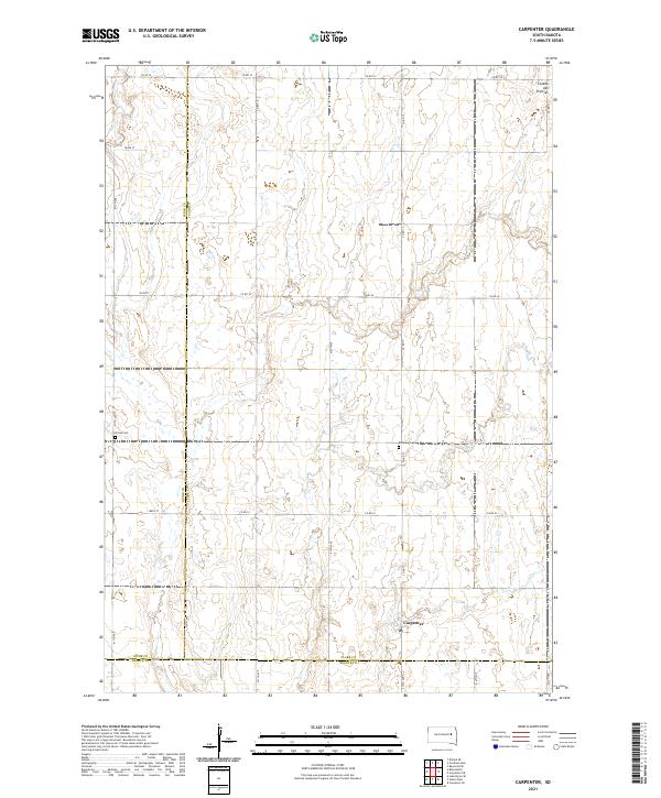
2021 Map of Carpenter
USGS Topo · Published 2021About this map
Carpenter serves as the primary hub for this agrarian landscape where the high plains begin to rise toward the Coteau des Prairies. The survey reveals a region defined by precise section lines and county boundaries, where Spink and Clark counties meet. Local history is anchored by the presence of Union Cem and Richland Cem, which stand as quiet landmarks among the expansive farm plots. The drainage of Foster Cr meanders through the northwest, highlighting the subtle hydrologic patterns of the eastern Dakotas. This 2021 update preserves the contemporary rural infrastructure, including the grid of secondary routes like Co RD 17 and Co RD 53 that facilitate the movement of goods in this remote corner of South Dakota.
Find a feature on this map
31 named features on this map. Tap any name to fly to it.
Don’t see what you’re looking for? This feature index may not catch every label — zoom into the map to look around manually.
Map Details
Editions of this 2021 Carpenter Map
This is the sole edition of this map. No revisions or reprints were ever made.
Other maps of this area

1895 · Byron
USGS Topo · 1:125,000

1953 · Huron
USGS Topo · 1:250,000

1953 · Watertown
USGS Topo · 1:250,000

1954 · Huron
USGS Topo · 1:250,000

1956 · Lake Byron SE
USGS Topo · 1:24,000

1958 · Watertown
USGS Topo · 1:250,000
1971 · Doland SE
USGS Topo · 1:24,000
1971 · Bloomfield
USGS Topo · 1:25,000
1973 · Staum Dam
USGS Topo · 1:24,000

1973 · Carpenter SE
USGS Topo · 1:24,000