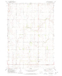
1973 Map of Carpenter
USGS Topo · Published 1978About this map
Richland and the nearby Richland Cem stand at the heart of this agricultural landscape in eastern South Dakota, where the survey lines of Richland, Union, and FordHAM townships create a precise grid across the plains. The map records a sparsely populated region defined by small community hubs like Carpenter and the small settlement of Dennis to the southwest. Foster Creek meanders through the northwest corner, providing a natural break in the geometric section lines that dominate the territory. For those researching local history, the documentation of Union Cem and the Townhall site offers specific points of interest for tracing early township organization and family burial locations. The landscape here is one of wide-open prairie agriculture, where local roads and section corners are the primary markers of human presence in the early 1970s.
Find a feature on this map
17 named features on this map. Tap any name to fly to it.
Don’t see what you’re looking for? This feature index may not catch every label — zoom into the map to look around manually.
Map Details
Editions of this 1973 Carpenter Map
This is the sole edition of this map. No revisions or reprints were ever made.
Other maps of this area

1895 · Byron
USGS Topo · 1:125,000

1953 · Huron
USGS Topo · 1:250,000

1953 · Watertown
USGS Topo · 1:250,000

1954 · Huron
USGS Topo · 1:250,000

1956 · Lake Byron SE
USGS Topo · 1:24,000

1958 · Watertown
USGS Topo · 1:250,000
1971 · Doland SE
USGS Topo · 1:24,000
1971 · Bloomfield
USGS Topo · 1:25,000
1973 · Staum Dam
USGS Topo · 1:24,000

1973 · Carpenter SE
USGS Topo · 1:24,000