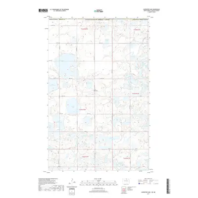
2017 Map of Carpenter Lake
USGS Topo · Published 2017About this map
The Turtle Mountains define this high-plateau landscape along the international boundary between the United States and Canada. This northern reach of Rolette County is characterized by a dense concentration of glacial lakes and potholes, varying from the large expanse of Carpenter Lake to smaller, family-named waters like Ziegler Lake, Dion Lake, and Ben Waters Lake. The terrain is a complex arrangement of wetlands and woodlands, navigated by a strict grid of section-line roads such as 109th St NE and 105th St NE. The presence of multiple School Section Lake labels indicates the historical reservation of land for public education support, a common feature of Western land surveys. To the south, the geography transitions toward Gravel Bottom Lake and Wendland Lake, while the eastern edge is marked by the rugged shoreline of Hooker Lake and Island Lake.
Find a feature on this map
49 named features on this map. Tap any name to fly to it.
Don’t see what you’re looking for? This feature index may not catch every label — zoom into the map to look around manually.
Map Details
Editions of this 2017 Carpenter Lake Map
This is the sole edition of this map. No revisions or reprints were ever made.
Other maps of this area

1935 · Dunseith
USGS Topo · 1:48,000

1936 · Lake Upsilon
USGS Topo · 1:48,000

1939 · Dunseith
USGS Topo · 1:62,500

1942 · Lake Upsilon
USGS Topo · 1:62,500

1953 · Devils Lake
USGS Topo · 1:250,000

1954 · Minot
USGS Topo · 1:250,000

1955 · Dunseith
USGS Topo · 1:24,000

1955 · Lake Upsilon SW
USGS Topo · 1:24,000

1956 · Devils Lake
USGS Topo · 1:250,000

1958 · Minot
USGS Topo · 1:250,000