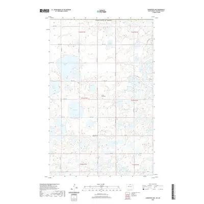
2020 Map of Carpenter Lake
USGS Topo · Published 2020About this map
The Turtle Mountains define this northern landscape, which is saturated by a dense network of glacial lakes and small water bodies. Located in Rolette County along the United States of America border, the area is characterized by its high concentration of named lakes, including Carpenter Lake, Hooker Lake, and Dion Lake. The local infrastructure is a mix of established county routes like Co Rd 43 and tribal roads such as BIA Rd 2, which navigate around the numerous wetlands. For those researching local heritage, the Saint John's Lutheran Cem stands as a primary landmark in the southern section of the quadrangle. The map reveals the rural land use patterns of the region, where roads like 108th St NE and 105th St NE divide the lake country into a regular grid, occasionally interrupted by features like School Section Lake.
Find a feature on this map
47 named features on this map. Tap any name to fly to it.
Don’t see what you’re looking for? This feature index may not catch every label — zoom into the map to look around manually.
Map Details
Editions of this 2020 Carpenter Lake Map
This is the sole edition of this map. No revisions or reprints were ever made.
Other maps of this area

1935 · Dunseith
USGS Topo · 1:48,000

1936 · Lake Upsilon
USGS Topo · 1:48,000

1939 · Dunseith
USGS Topo · 1:62,500

1942 · Lake Upsilon
USGS Topo · 1:62,500

1953 · Devils Lake
USGS Topo · 1:250,000

1954 · Minot
USGS Topo · 1:250,000

1955 · Dunseith
USGS Topo · 1:24,000

1955 · Lake Upsilon SW
USGS Topo · 1:24,000

1956 · Devils Lake
USGS Topo · 1:250,000

1958 · Minot
USGS Topo · 1:250,000