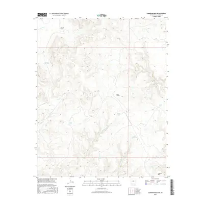
2017 Map of Carpenter Mesa NW
USGS Topo · Published 2017About this map
Carpenter Mesa anchor the southeastern corner of this terrain, where the high ground gives way to a complex system of drainage and seasonal water storage in San Miguel County. The landscape is defined by its network of canyons and creeks, most notably Cow Pass Canyon and Road Canyon, which funnel runoff from the surrounding heights. Scattered throughout the area are numerous named earthen tanks—critical infrastructure for livestock in this arid environment—including Saint Patrick Tank, Watrous Tank, and Gacho Tank. These features, along with waterways like Cow Pass Cr and Saint Patrick Cr, reveal the intricate water management essential for ranching operations in this part of New Mexico. The absence of major settlements highlights the land's primary use for open-range grazing and resource management during the mid-2010s.
Find a feature on this map
19 named features on this map. Tap any name to fly to it.
Don’t see what you’re looking for? This feature index may not catch every label — zoom into the map to look around manually.
Map Details
Editions of this 2017 Carpenter Mesa NW Map
This is the sole edition of this map. No revisions or reprints were ever made.
Other maps of this area

1930 · Tucumcari
USGS Topo · 1:125,000

1954 · Santa Fe
USGS Topo · 1:250,000

1954 · Tucumcari
USGS Topo · 1:250,000

1958 · Santa Fe
USGS Topo · 1:250,000

1958 · Tucumcari
USGS Topo · 1:250,000

1967 · Trinchera Creek
USGS Topo · 1:24,000

1967 · Monument Point
USGS Topo · 1:24,000

1968 · La Cinta Mesa
USGS Topo · 1:24,000

1968 · Carpenter Mesa SW
USGS Topo · 1:24,000

1968 · Carpenter Mesa NW
USGS Topo · 1:24,000