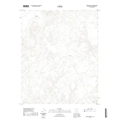
2020 Map of Carpenter Mesa NW
USGS Topo · Published 2020About this map
Carpenter Mesa anchors the southeastern corner of this high-plains landscape in San Miguel County, where a complex network of seasonal drainages and stock-water infrastructure defines the territory. The terrain is marked by deep incisions like Cow Pass Canyon and Road Canyon, which channel intermittent flows through various creeks including Watrous Cr, Chical Cr, and Rattlesnake Cr. The reliance on surface water management is evident through numerous named collection points, such as Saint Patrick Tank, Blanco Tank, and Tony Tank, essential for sustaining life in this arid region. These features suggest a ranching landscape where natural topography and human-made tanks work in tandem to support livestock. This modern survey reflects a largely unpopulated but highly managed environment, illustrating how geographic names often follow functional markers like water sources and transit passes.
Find a feature on this map
18 named features on this map. Tap any name to fly to it.
Don’t see what you’re looking for? This feature index may not catch every label — zoom into the map to look around manually.
Map Details
Editions of this 2020 Carpenter Mesa NW Map
This is the sole edition of this map. No revisions or reprints were ever made.
Other maps of this area

1930 · Tucumcari
USGS Topo · 1:125,000

1954 · Santa Fe
USGS Topo · 1:250,000

1954 · Tucumcari
USGS Topo · 1:250,000

1958 · Santa Fe
USGS Topo · 1:250,000

1958 · Tucumcari
USGS Topo · 1:250,000

1967 · Trinchera Creek
USGS Topo · 1:24,000

1967 · Monument Point
USGS Topo · 1:24,000

1968 · La Cinta Mesa
USGS Topo · 1:24,000

1968 · Carpenter Mesa SW
USGS Topo · 1:24,000

1968 · Carpenter Mesa NW
USGS Topo · 1:24,000