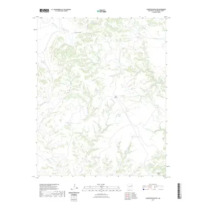
2023 Map of Carpenter Mesa NW
USGS Topo · Published 2023About this map
Carpenter Mesa defines the southern reach of this San Miguel County landscape, where the high ground transitions into a complex network of drainages and canyons. The terrain is marked by a legacy of water management essential for ranching in the high desert, evidenced by numerous named catchment features like Saint Patrick Tank, Blanco Tank, and Gacho Tank. These improvements are strategically positioned near natural waterways such as Watrous Creek and Saint Patrick Creek.
Find a feature on this map
18 named features on this map. Tap any name to fly to it.
Don’t see what you’re looking for? This feature index may not catch every label — zoom into the map to look around manually.
Map Details
Editions of this 2023 Carpenter Mesa NW Map
This is the sole edition of this map. No revisions or reprints were ever made.
Other maps of this area

1930 · Tucumcari
USGS Topo · 1:125,000

1954 · Santa Fe
USGS Topo · 1:250,000

1954 · Tucumcari
USGS Topo · 1:250,000

1958 · Santa Fe
USGS Topo · 1:250,000

1958 · Tucumcari
USGS Topo · 1:250,000

1967 · Trinchera Creek
USGS Topo · 1:24,000

1967 · Monument Point
USGS Topo · 1:24,000

1968 · La Cinta Mesa
USGS Topo · 1:24,000

1968 · Carpenter Mesa SW
USGS Topo · 1:24,000

1968 · Carpenter Mesa NW
USGS Topo · 1:24,000