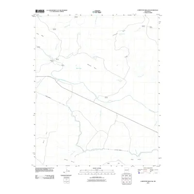
2010 Map of Carpenter Mesa SW
USGS Topo · Published 2010About this map
Carpenter Mesa and Manhead Mesa dominate this New Mexico high-desert terrain, where water management is the primary marker of human activity. The presence of the Conchas Canal cutting across the lower portion of the sheet, supported by infrastructure like Tunnel Number 3 and Tunnel Number 4, illustrates the engineering required to move water through this arid landscape. The Canadian River winds through the center, joined by seasonal drainages such as Watrous Creek and Saint Patrick Creek. Numerous windmills and tanks, including Hells Hole Windmill, Sarsaparilla Windmill, and McCauley Tank, are scattered across the mesas and rincons. These features highlight the importance of localized water sources for ranching operations in Johnson Rincon and Road Rincon during the early 21st century.
Find a feature on this map
31 named features on this map. Tap any name to fly to it.
Don’t see what you’re looking for? This feature index may not catch every label — zoom into the map to look around manually.
Map Details
Editions of this 2010 Carpenter Mesa SW Map
This is the sole edition of this map. No revisions or reprints were ever made.
Other maps of this area

1930 · Tucumcari
USGS Topo · 1:125,000

1954 · Santa Fe
USGS Topo · 1:250,000

1954 · Tucumcari
USGS Topo · 1:250,000

1958 · Santa Fe
USGS Topo · 1:250,000

1958 · Tucumcari
USGS Topo · 1:250,000

1964 · Muniz Canyon
USGS Topo · 1:24,000

1967 · Trinchera Creek
USGS Topo · 1:24,000

1967 · Monument Point
USGS Topo · 1:24,000

1967 · Liberty Mesa
USGS Topo · 1:24,000

1968 · La Cinta Mesa
USGS Topo · 1:24,000