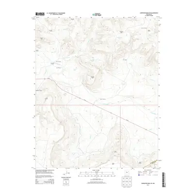
2013 Map of Carpenter Mesa SW
USGS Topo · Published 2013About this map
The Canadian River cuts through this high plains landscape of northeastern New Mexico, defining the transition between significant plateau formations and canyon bottoms. The geography is dominated by large tablelands like Carpenter Mesa and Mesa Rica, with drainage provided by seasonal watercourses such as Carpenter Cr and Johnson Cr. This region relies on an intricate network of water management features, including several stock tanks like McCawley Tank and Toni Tank, alongside specialized landmarks such as Sarsaparilla Windmill and Boxcar Windmill. Infrastructure is sparse but critical, anchored by NM-104 and engineering markers including Tunnel Number 3 and Tunnel Number 4. The map reveals the pastoral and hydrological priorities of the area, notably the presence of the Conchas Canal winding through the southwestern portion of the quadrangle near the boundary of San Miguel and Quay counties.
Find a feature on this map
32 named features on this map. Tap any name to fly to it.
Don’t see what you’re looking for? This feature index may not catch every label — zoom into the map to look around manually.
Map Details
Editions of this 2013 Carpenter Mesa SW Map
This is the sole edition of this map. No revisions or reprints were ever made.
Other maps of this area

1930 · Tucumcari
USGS Topo · 1:125,000

1954 · Santa Fe
USGS Topo · 1:250,000

1954 · Tucumcari
USGS Topo · 1:250,000

1958 · Santa Fe
USGS Topo · 1:250,000

1958 · Tucumcari
USGS Topo · 1:250,000

1964 · Muniz Canyon
USGS Topo · 1:24,000

1967 · Trinchera Creek
USGS Topo · 1:24,000

1967 · Monument Point
USGS Topo · 1:24,000

1967 · Liberty Mesa
USGS Topo · 1:24,000

1968 · La Cinta Mesa
USGS Topo · 1:24,000