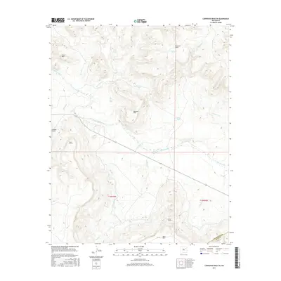
2017 Map of Carpenter Mesa SW
USGS Topo · Published 2017About this map
Canadian River winds through this high plains landscape, carving deep relief between massive landforms such as Carpenter Mesa and Chical Mesa. The 2017 terrain is defined by its water management infrastructure, most notably the Conchas Canal and the engineering of Tunnel Number 3 and Tunnel Number 4. These features illustrate the complex irrigation and transport systems required to move water across the arid mesas. Named stock tanks like Bollschweiler Tank, McCayley Tank, and Toni Tank are scattered throughout the region, serving as vital landmarks for local ranching operations. The convergence of numerous drainages, including Saint Patrick Cr, Watrous Cr, and Alamosa Cr, into the main river canyon highlights the importance of this watershed. In the southern reaches, the elevation rises toward Mesa Rica, while the boundary between San Miguel and Quay Counties marks the southeastern corner of the survey.
Find a feature on this map
25 named features on this map. Tap any name to fly to it.
Don’t see what you’re looking for? This feature index may not catch every label — zoom into the map to look around manually.
Map Details
Editions of this 2017 Carpenter Mesa SW Map
This is the sole edition of this map. No revisions or reprints were ever made.
Other maps of this area

1930 · Tucumcari
USGS Topo · 1:125,000

1954 · Santa Fe
USGS Topo · 1:250,000

1954 · Tucumcari
USGS Topo · 1:250,000

1958 · Santa Fe
USGS Topo · 1:250,000

1958 · Tucumcari
USGS Topo · 1:250,000

1964 · Muniz Canyon
USGS Topo · 1:24,000

1967 · Trinchera Creek
USGS Topo · 1:24,000

1967 · Monument Point
USGS Topo · 1:24,000

1967 · Liberty Mesa
USGS Topo · 1:24,000

1968 · La Cinta Mesa
USGS Topo · 1:24,000