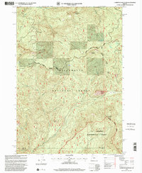
1997 Map of Carpenter Mountain
USGS Topo · Published 2001About this map
Willamette National Forest encompasses the high Cascades landscape of this late-1990s survey, defined by its steep volcanic peaks and intricate drainage systems. The northern portion is dominated by the headwaters of the South Santiam River, where Sevenmile Creek and Three Creek carve through the terrain near Jumpoff Joe Mountain. A central management boundary separates the Sweet Home Ranger District from the Blue River Ranger District, reflecting the administrative organization of these timber and watershed lands.
Find a feature on this map
26 named features on this map. Tap any name to fly to it.
Don’t see what you’re looking for? This feature index may not catch every label — zoom into the map to look around manually.
Map Details
Editions of this 1997 Carpenter Mountain Map
This is the sole edition of this map. No revisions or reprints were ever made.
Other maps of this area

1934 · Mc Kenzie Bridge
USGS Topo · 1:96,000

1940 · Mc Kenzie Bridge
USGS Topo · 1:125,000

1953 · Salem
USGS Topo · 1:250,000

1954 · Salem
USGS Topo · 1:250,000

1955 · Blue River
USGS Topo · 1:62,500

1955 · Cascadia
USGS Topo · 1:62,500

1955 · Echo Mountain
USGS Topo · 1:62,500

1955 · Mc Kenzie Bridge
USGS Topo · 1:62,500

1960 · Salem
USGS Topo · 1:250,000

1962 · Salem
USGS Topo · 1:250,000