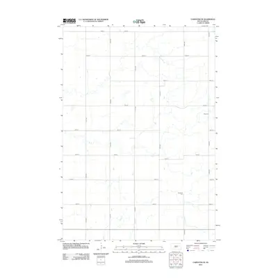
2012 Map of Carpenter NE
USGS Topo · Published 2012About this map
Shue Cr and Pearl Cr meander through this rural section of Beadle County, illustrating the intricate drainage patterns of the eastern South Dakota plains. The landscape is defined by a rigorous section-line road grid, where North-South thoroughfares like 420th Ave and 422nd Ave intersect with East-West routes including 186th St and 189th St. This area maintains its agricultural character, with scattered homesteads and small water bodies punctuating the open prairie.
Find a feature on this map
19 named features on this map. Tap any name to fly to it.
Don’t see what you’re looking for? This feature index may not catch every label — zoom into the map to look around manually.
Map Details
Editions of this 2012 Carpenter NE Map
This is the sole edition of this map. No revisions or reprints were ever made.
Other maps of this area

1953 · Watertown
USGS Topo · 1:250,000

1958 · Watertown
USGS Topo · 1:250,000
1973 · Staum Dam
USGS Topo · 1:24,000

1973 · Carpenter SE
USGS Topo · 1:24,000

1973 · Willow Lake
USGS Topo · 1:24,000

1973 · Clark South
USGS Topo · 1:24,000
1973 · Carpenter
USGS Topo · 1:24,000
1973 · Willow Lake SW
USGS Topo · 1:24,000
1973 · Raymond SE
USGS Topo · 1:24,000
1973 · Carpenter NE
USGS Topo · 1:24,000